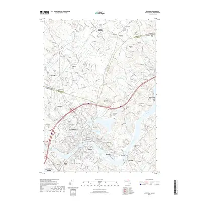
2018 Map of Haverhill
USGS Topo · Published 2018About this map
The Merrimack River serves as the central artery of this region, separating Haverhill and Bradford while flowing past Hales Island toward the coast. This landscape is defined by its numerous water bodies, including Lake Pentucket, Kenoza Lake, and Lake Saltonstall, which sit amidst a network of residential growth and institutional landmarks. For genealogists and local historians, the area is exceptionally dense with burial grounds such as Linwood Cem, Saint Josephs Cem, and the Children of Israel Cem. Connectivity between communities is maintained by notable crossings like Rocks Bridge and Bates Bridge, linking the urban center to outlying settlements like Rocks Village and Groveland. The map also captures the presence of Northern Essex Community College and Northpoint Bible College, reflecting the area's role as an educational hub.
Find a feature on this map
73 named features on this map. Tap any name to fly to it.
Don’t see what you’re looking for? This feature index may not catch every label — zoom into the map to look around manually.
Map Details
Editions of this 2018 Haverhill Map
This is the sole edition of this map. No revisions or reprints were ever made.
Other maps of this area

1886 · Lawrence
USGS Topo · 1:62,500

1888 · Newburyport
USGS Topo · 1:62,500

1888 · Haverhill
USGS Topo · 1:62,500

1888 · Lawrence
USGS Topo · 1:62,500

1888 · Salem
USGS Topo · 1:62,500

1890 · Haverhill
USGS Topo · 1:62,500

1890 · Newburyport
USGS Topo · 1:62,500

1893 · Salem
USGS Topo · 1:62,500

1893 · Lawrence
USGS Topo · 1:62,500

1893 · Haverhill
USGS Topo · 1:62,500