
1956 Map of Hawes
USGS Topo · Published 1957About this map
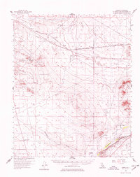
The Mojave River carves through the southeastern corner of this high-desert landscape, creating a focal point for settlement and transportation between the Iron Mountain and Kramer Hills ranges. During the mid-1950s, this region served as a critical corridor for both civil and military infrastructure, evidenced by the Hawes Auxiliary Airport and Helendale Auxiliary Airport. The infrastructure is further defined by the parallel paths of the Atchison Topeka and Santa Fe and Union Pacific railroads, which mirror the historical route of the Bonanza Trail. Local ranching and mining history is preserved through labels for the Astley Rancho and various prospects and shafts dotting the hills. Distinctive landmarks like Point of Rocks and the small siding at Jimgrey illustrate the sparse but vital network of early California desert outposts.
Find a feature on this map
26 named features on this map. Tap any name to fly to it.
Don’t see what you’re looking for? This feature index may not catch every label — zoom into the map to look around manually.
Map Details
Editions of this 1956 Hawes Map
3 editions found

Other maps of this area

1915 · Searles Lake
USGS Topo · 1:250,000

1932 · Barstow
USGS Topo · 1:125,000

1934 · Barstow
USGS Topo · 1:125,000

1937 · Shadow Mountains
USGS Topo · 1:48,000

1937 · Kramer
USGS Topo · 1:48,000

1942 · Kramer
USGS Topo · 1:62,500

1942 · Shadow Mountains
USGS Topo · 1:62,500

1947 · Kramer
USGS Topo · 1:24,000

1947 · Johannesburg SE
USGS Topo · 1:25,000

1947 · Red Buttes
USGS Topo · 1:24,000