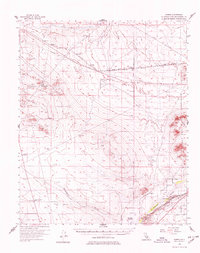
1956 Map of Hawes
USGS Topo · Published 1978About this map
The Mojave River carves a critical path through this high desert region, anchoring the settlements and infrastructure of the mid-1950s. The landscape is defined by the vital transportation corridor of the Atchison Topeka and Santa Fe and Union Pacific railroads, which parallel the river and ancient paths like the Bonanza Trail. Military and aviation needs of the era are evident in the presence of the Hawes Auxiliary Airport and Helendale Auxiliary Airport, reflecting the strategic importance of the open terrain near Harper Lake. Local industry is marked by scattered prospects, shafts, and oil wells, particularly around the Kramer Hills. For genealogists and local historians, specific landmarks like Astley Rancho, Helendale Ranch, and the Point of Rocks offer precise location data for historical homesteads and geographic markers along the river's bend.
Find a feature on this map
25 named features on this map. Tap any name to fly to it.
Don’t see what you’re looking for? This feature index may not catch every label — zoom into the map to look around manually.
Map Details
Editions of this 1956 Hawes Map
3 editions found


Other maps of this area

1915 · Searles Lake
USGS Topo · 1:250,000

1932 · Barstow
USGS Topo · 1:125,000

1934 · Barstow
USGS Topo · 1:125,000

1937 · Shadow Mountains
USGS Topo · 1:48,000

1937 · Kramer
USGS Topo · 1:48,000

1942 · Kramer
USGS Topo · 1:62,500

1942 · Shadow Mountains
USGS Topo · 1:62,500

1947 · Kramer
USGS Topo · 1:24,000

1947 · Johannesburg SE
USGS Topo · 1:25,000

1947 · Red Buttes
USGS Topo · 1:24,000