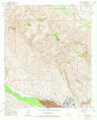
1964 Map of Hayden
USGS Topo · Published 1973About this map
Industrial activity and copper extraction dominate this mid-century view of Hayden, where the Gila River forms the southern boundary of a landscape defined by the Dripping Spring Mountains. The town's heavy industrial footprint is evident in the sprawling Tailings Pond and Velasco Pit, while the Southern Pacific railroad serves as the vital transport artery for the region's mineral wealth.
Find a feature on this map
35 named features on this map. Tap any name to fly to it.
Don’t see what you’re looking for? This feature index may not catch every label — zoom into the map to look around manually.
Map Details
Editions of this 1964 Hayden Map
3 editions found
Other maps of this area

1910 · Ray
USGS Topo · 1:62,500

1911 · Winkelman
USGS Topo · 1:125,000

1913 · Winkelman
USGS Topo · 1:125,000

1915 · Christmas
USGS Topo · 1:62,500

1917 · Christmas
USGS Topo · 1:62,500

1949 · Holy Joe Peak
USGS Topo · 1:62,500

1949 · Crozier Peak
USGS Topo · 1:24,000

1949 · Winkelman
USGS Topo · 1:24,000

1949 · Winkelman
USGS Topo · 1:62,500

1949 · Saddle Mtn.
USGS Topo · 1:24,000