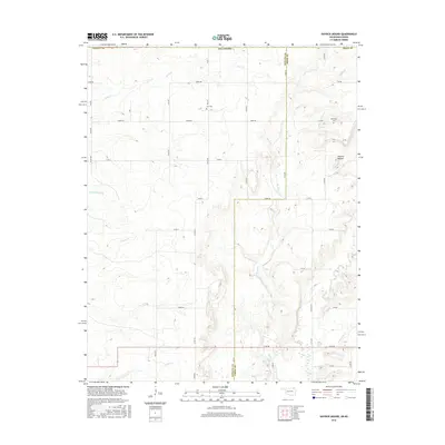
2016 Map of Hayrick Mound
USGS Topo · Published 2016About this map
Hayrick Mound stands as the primary topographic landmark in this borderland where the Kansas plains meet Oklahoma. This 2016 survey documents the rural agricultural character of the region, defined by a grid of section roads and a complex network of prairie streams. The landscape is deeply dissected by drainages including Rock Cr, Brush Cr, and Crow Hollow Cr, which dictate the placement of farms and transit corridors. For those researching local family history, the map identifies small, remote burial grounds such as Lain Cem and Plainview Cem, which often represent the only remaining markers of early farming communities. The southern edge of the map tracks the administrative boundary between Nowata Co and Craig Co, showing how the modern road network, including E 90 RD and E 0080 RD, continues to follow the historic township and range lines established over a century ago.
Find a feature on this map
26 named features on this map. Tap any name to fly to it.
Don’t see what you’re looking for? This feature index may not catch every label — zoom into the map to look around manually.
Map Details
Editions of this 2016 Hayrick Mound Map
This is the sole edition of this map. No revisions or reprints were ever made.
Other maps of this area

1886 · Independence
USGS Topo · 1:125,000

1886 · Parsons
USGS Topo · 1:125,000

1893 · Parsons
USGS Topo · 1:125,000

1894 · Independence
USGS Topo · 1:125,000

1901 · Nowata
USGS Topo · 1:125,000

1901 · Vinita
USGS Topo · 1:125,000

1905 · Independence
USGS Topo · 1:125,000

1913 · Vinita
USGS Topo · 1:125,000

1914 · Nowata
USGS Topo · 1:125,000

1946 · Mound Valley
USGS Topo · 1:62,500