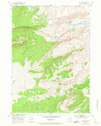
1952 Map of Hays Park
USGS Topo · Published 1973About this map
The Shoshone National Forest and Wind River Indian Reservation share a rugged mountain boundary in this 1952 field-checked study. The landscape is defined by the massive uplift of the Wind River Range, where high-elevation landmarks like Dinwoody Peak and Sacagawea Ridge overlook a complex network of glacial drainage. The transition from alpine crests to the lower basin is traced through features like the Natural Bridge on Dinwoody Creek, providing a detailed look at the hydrology before modern development.
Find a feature on this map
24 named features on this map. Tap any name to fly to it.
Don’t see what you’re looking for? This feature index may not catch every label — zoom into the map to look around manually.
Map Details
Editions of this 1952 Hays Park Map
5 editions found
Other maps of this area

1909 · Fremont Peak
USGS Topo · 1:125,000

1952 · Wilderness
USGS Topo · 1:24,000

1952 · Hays Park
USGS Topo · 1:24,000

1952 · Bob Lakes
USGS Topo · 1:24,000

1952 · Blue Holes
USGS Topo · 1:24,000

1952 · Burris
USGS Topo · 1:24,000

1952 · Kirkland Park
USGS Topo · 1:24,000

1955 · Thermopolis
USGS Topo · 1:250,000

1958 · Thermopolis
USGS Topo · 1:250,000

1962 · Thermopolis
USGS Topo · 1:250,000