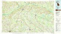
1979 Map of Hazlehurst
USGS Topo · Published 1980About this map
The confluence of the Ocmulgee River and the Oconee River marks the beginning of the Altamaha River in this late-1970s survey of Southeast Georgia. This river system historically served as a vital interior transportation corridor, a role later assumed by the robust rail networks of the Southern, Central of Georgia, and Seaboard Coast Line railroads that converge at Hazlehurst. The landscape is defined by the broad, meandering basins of the Satilla River and Little Satilla River, interspersed with smaller communities such as Lumber City and Baxley. In addition to the established regional centers of Douglas and Nicholls, the map traces industrial infrastructure like the Pine Grove Pipeline, which cuts across the agrarian terrain. This survey reflects a period when traditional river and rail hubs were increasingly supported by regional aviation facilities, including the Baxley Municipal Airport and Bacon County Airport.
Find a feature on this map
43 named features on this map. Tap any name to fly to it.
Don’t see what you’re looking for? This feature index may not catch every label — zoom into the map to look around manually.
Map Details
Editions of this 1979 Hazlehurst Map
This is the sole edition of this map. No revisions or reprints were ever made.
Other maps of this area

1918 · Jesup
USGS Topo · 1:62,500

1918 · Hortense
USGS Topo · 1:62,500

1919 · Claxton
USGS Topo · 1:62,500

1920 · Glennville
USGS Topo · 1:62,500

1943 · Jesup
USGS Topo · 1:62,500

1944 · Claxton
USGS Topo · 1:62,500

1944 · Hortense
USGS Topo · 1:62,500

1944 · Glennville
USGS Topo · 1:62,500

1946 · Brunswick
USGS Topo · 1:250,000

1947 · Savannah
USGS Topo · 1:250,000