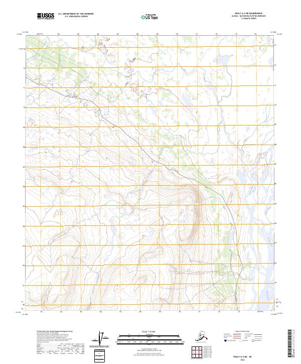
2024 Map of Healy A-2 NE
USGS Topo · Published 2024About this map
The Susitna River carves a massive glacial corridor through the eastern edge of this Matanuska-Susitna interior landscape. The Denali Highway provides the primary high-latitude access across the northern terrain, connecting remote drainages like Monahan Creek and Wickersham Creek. The drainage pattern here illustrates a complex subarctic watershed where Valdez Creek meets the main river valley.
Find a feature on this map
15 named features on this map. Tap any name to fly to it.
Don’t see what you’re looking for? This feature index may not catch every label — zoom into the map to look around manually.
Map Details
Editions of this 2024 Healy A-2 NE Map
This is the sole edition of this map. No revisions or reprints were ever made.
Other maps of this area

1949 · Healy B-2
USGS Topo · 1:63,360

1949 · Healy A-1
USGS Topo · 1:63,360

1950 · Healy B-1
USGS Topo · 1:63,360

1951 · Healy
USGS Topo · 1:250,000

1951 · Healy A-2
USGS Topo · 1:63,360
1952 · Healy A-1
USGS Topo · 1:63,360

1952 · Healy B-1
USGS Topo · 1:63,360

1952 · Healy A-2
USGS Topo · 1:63,360

1952 · Healy B-2
USGS Topo · 1:63,360

1956 · Healy
USGS Topo · 1:250,000