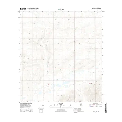
2016 Map of Healy A-2 SW
USGS Topo · Published 2016About this map
Butte Creek and Gold Creek define the drainage patterns of this Alaskan interior landscape within the Matanuska-Susitna Borough. The terrain is characterized by significant elevation changes, documented through precise contour intervals that reveal the complex geography of the Talkeetna Mountains region. This 2016 survey reflects the modern mapping of the Public Land Survey System, specifically within the boundaries of t21s r2w, t21s r1w, t22s r2w, and t22s r1w. The lack of named roads or settlements emphasizes the remote nature of this wilderness area, where the primary geographic identifiers remain the natural watercourses and the established township and range grid.
Find a feature on this map
6 named features on this map. Tap any name to fly to it.
Don’t see what you’re looking for? This feature index may not catch every label — zoom into the map to look around manually.
Map Details
Editions of this 2016 Healy A-2 SW Map
This is the sole edition of this map. No revisions or reprints were ever made.
Other maps of this area

1950 · Talkeetna Mountains
USGS Topo · 1:250,000

1950 · Healy A-3
USGS Topo · 1:63,360

1951 · Healy
USGS Topo · 1:250,000

1951 · Talkeetna Mountains D-2
USGS Topo · 1:63,360

1951 · Talkeetna Mountains D-3
USGS Topo · 1:63,360

1951 · Healy A-2
USGS Topo · 1:63,360
1952 · Healy A-3
USGS Topo · 1:63,360

1952 · Healy A-2
USGS Topo · 1:63,360
1952 · Talkeetna Mountains D-2
USGS Topo · 1:63,360
1953 · Talkeetna Mountains D-3
USGS Topo · 1:63,360