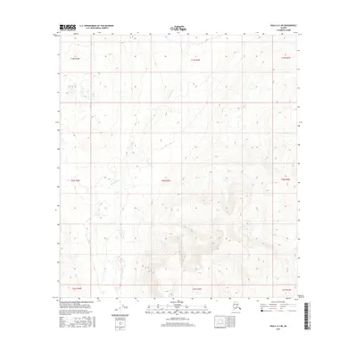
2016 Map of Healy A-3 NE
USGS Topo · Published 2016About this map
Brushkana Cr winds through the northern and western reaches of this remote interior Alaska landscape, providing a primary hydrological reference point for the high-latitude terrain. This 2016 survey, published by the U.S. Geological Survey, meticulously details the elevation and drainage patterns across several townships, including t19s r3w and t20s r3w. The map focuses on the natural contours of the Matanuska-Susitna region, where steep gradients and glacial valleys predominate. Without established settlements or roadways, the document serves as an essential record of the undisturbed wilderness and the path of Brushkana Cr as it carves through the subarctic landscape.
Find a feature on this map
10 named features on this map. Tap any name to fly to it.
Don’t see what you’re looking for? This feature index may not catch every label — zoom into the map to look around manually.
Map Details
Editions of this 2016 Healy A-3 NE Map
This is the sole edition of this map. No revisions or reprints were ever made.
Other maps of this area

1949 · Healy B-2
USGS Topo · 1:63,360

1950 · Healy A-3
USGS Topo · 1:63,360

1950 · Healy B-3
USGS Topo · 1:63,360

1951 · Healy
USGS Topo · 1:250,000

1951 · Healy A-2
USGS Topo · 1:63,360
1952 · Healy A-3
USGS Topo · 1:63,360
1952 · Healy B-3
USGS Topo · 1:63,360

1952 · Healy A-2
USGS Topo · 1:63,360

1952 · Healy B-2
USGS Topo · 1:63,360

1956 · Healy
USGS Topo · 1:250,000