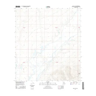
2016 Map of Healy B-1 SW
USGS Topo · Published 2016About this map
The Susitna River and its major tributaries dominate this high-latitude drainage basin within the Alaska Range. This 2016 survey documents the complex braided channels and glacial runoff patterns of the East Fork Susitna River and West Fork Susitna River as they converge. The eastern edge of the quadrangle is defined by the steep rising slopes of the Clearwater Mountains, a region characterized by significant elevation changes and seasonal hydrological shifts. Unlike more developed Alaskan regions, the landscape here remains centered on the natural water system, providing a baseline for environmental study and topographical tracing of the Matanuska-Susitna borough's river-fed wilderness.
Find a feature on this map
10 named features on this map. Tap any name to fly to it.
Don’t see what you’re looking for? This feature index may not catch every label — zoom into the map to look around manually.
Map Details
Editions of this 2016 Healy B-1 SW Map
This is the sole edition of this map. No revisions or reprints were ever made.
Other maps of this area

1949 · Healy B-2
USGS Topo · 1:63,360

1949 · Healy A-1
USGS Topo · 1:63,360

1950 · Healy B-1
USGS Topo · 1:63,360

1951 · Healy
USGS Topo · 1:250,000

1951 · Healy A-2
USGS Topo · 1:63,360
1952 · Healy A-1
USGS Topo · 1:63,360

1952 · Healy B-1
USGS Topo · 1:63,360

1952 · Healy A-2
USGS Topo · 1:63,360

1952 · Healy B-2
USGS Topo · 1:63,360

1956 · Healy
USGS Topo · 1:250,000