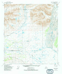
1949 Map of Healy B-2
USGS Topo · Published 1994About this map
The Nenana River flows through this subarctic interior landscape, carving through the high country of the Alaska Range during a period of expanding northern infrastructure. The 1949 aerial photography used for this map captures a significant transitional moment for the region, specifically documenting the presence of the Denali Highway as it traverses the southern section of the quadrangle. This critical route provided early road access to the wilderness before the completion of the modern George Parks Highway. To the north, the massive Nenana Glacier and West Fork Glacier dominate the high-altitude terrain, feeding the glacial braided systems of the West Fork Susitna River. Between these mountain flanks lies Monahan Flat, a low-lying expanse drained by Monahan Creek, illustrating the characteristic drainage patterns of the Matanuska-Susitna Borough’s northern reaches.
Find a feature on this map
13 named features on this map. Tap any name to fly to it.
Don’t see what you’re looking for? This feature index may not catch every label — zoom into the map to look around manually.
Map Details
Editions of this 1949 Healy B-2 Map
2 editions found
Other maps of this area

1949 · Healy C-3
USGS Topo · 1:63,360

1949 · Healy B-2
USGS Topo · 1:63,360

1949 · Healy A-1
USGS Topo · 1:63,360

1950 · Healy A-3
USGS Topo · 1:63,360

1950 · Healy B-3
USGS Topo · 1:63,360

1950 · Healy B-1
USGS Topo · 1:63,360

1951 · Healy
USGS Topo · 1:250,000

1951 · Healy C-1
USGS Topo · 1:63,360

1951 · Healy C-2
USGS Topo · 1:63,360

1951 · Healy A-2
USGS Topo · 1:63,360