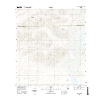
2016 Map of Healy B-2 NE
USGS Topo · Published 2016About this map
The Alaska Range dominates this high-altitude Alaskan landscape, where ice and elevation define the geography. The presence of the W Fork Glacier on the eastern edge of the sheet illustrates the active glacial processes at work in this part of the interior. This topographic survey captures the rugged transition between administrative districts, marking the boundary where the Denali Borough and Matanuska-Susitna Borough meet. The area is largely defined by severe vertical relief and hydrologic features typical of the subarctic, providing a technical look at the drainage patterns and ice fields that characterize the region north of the Talkeetna Mountains before modern infrastructure reached these higher elevations.
Find a feature on this map
9 named features on this map. Tap any name to fly to it.
Don’t see what you’re looking for? This feature index may not catch every label — zoom into the map to look around manually.
Map Details
Editions of this 2016 Healy B-2 NE Map
This is the sole edition of this map. No revisions or reprints were ever made.
Other maps of this area

1949 · Healy B-2
USGS Topo · 1:63,360

1950 · Healy B-1
USGS Topo · 1:63,360

1951 · Healy
USGS Topo · 1:250,000

1951 · Healy C-1
USGS Topo · 1:63,360

1951 · Healy C-2
USGS Topo · 1:63,360

1952 · Healy B-1
USGS Topo · 1:63,360

1952 · Healy B-2
USGS Topo · 1:63,360

1956 · Healy
USGS Topo · 1:250,000
2016 · Healy C-1 SW
USGS Topo · 1:25,000
2016 · Healy B-1 NW
USGS Topo · 1:25,000