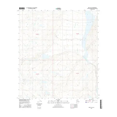
2016 Map of Healy B-2 SE
USGS Topo · Published 2016About this map
West Fork Susitna River and its upper tributaries dominate this interior Alaskan landscape, which remains largely defined by the hydrologic patterns of the Matanuska-Susitna region. The terrain is characterized by the braided path of the river as it flows through the eastern portion of the survey area, joined by drainage from Monahan Cr to the south. This 2016 survey illustrates the remote, undeveloped character of the Alaskan wilderness near the Denali area, where no permanent settlements or road infrastructure appear on the landscape. The map serves as a detailed record of high-altitude wetlands and glacial runoff patterns, with the W Fork Susitna River carving a significant corridor through the surrounding townships. For those studying the hydrography of the Susitna basin, the interplay between these watercourses provides critical insight into the drainage networks of the Alaska Range foothills.
Find a feature on this map
7 named features on this map. Tap any name to fly to it.
Don’t see what you’re looking for? This feature index may not catch every label — zoom into the map to look around manually.
Map Details
Editions of this 2016 Healy B-2 SE Map
This is the sole edition of this map. No revisions or reprints were ever made.
Other maps of this area

1949 · Healy B-2
USGS Topo · 1:63,360

1949 · Healy A-1
USGS Topo · 1:63,360

1950 · Healy B-1
USGS Topo · 1:63,360

1951 · Healy
USGS Topo · 1:250,000

1951 · Healy A-2
USGS Topo · 1:63,360
1952 · Healy A-1
USGS Topo · 1:63,360

1952 · Healy B-1
USGS Topo · 1:63,360

1952 · Healy A-2
USGS Topo · 1:63,360

1952 · Healy B-2
USGS Topo · 1:63,360

1956 · Healy
USGS Topo · 1:250,000