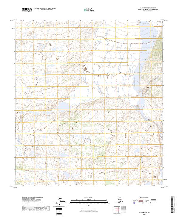
2024 Map of Healy B-2 SE
USGS Topo · Published 2024About this map
The West Fork Susitna River dominates the eastern edge of this landscape in the Matanuska-Susitna Borough, where glacial-fed waters carve a broad path through the interior. To the south, Monahan Creek flows through a series of complex contours and wetlands, illustrating the intricate drainage patterns typical of this Alaskan wilderness. The terrain is defined by its water systems and public land survey boundaries, including Fen Creek in the northwest. This 2024 topographic study by the U.S. Geological Survey details a region largely untouched by permanent road infrastructure or named settlements, highlighting the natural hydrological network that dictates travel and access in this remote territory.
Find a feature on this map
7 named features on this map. Tap any name to fly to it.
Don’t see what you’re looking for? This feature index may not catch every label — zoom into the map to look around manually.
Map Details
Editions of this 2024 Healy B-2 SE Map
This is the sole edition of this map. No revisions or reprints were ever made.
Other maps of this area

1949 · Healy B-2
USGS Topo · 1:63,360

1949 · Healy A-1
USGS Topo · 1:63,360

1950 · Healy B-1
USGS Topo · 1:63,360

1951 · Healy
USGS Topo · 1:250,000

1951 · Healy A-2
USGS Topo · 1:63,360
1952 · Healy A-1
USGS Topo · 1:63,360

1952 · Healy B-1
USGS Topo · 1:63,360

1952 · Healy A-2
USGS Topo · 1:63,360

1952 · Healy B-2
USGS Topo · 1:63,360

1956 · Healy
USGS Topo · 1:250,000