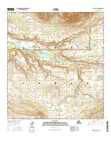
2016 Map of Healy B-3 SE
USGS Topo · Published 2016About this map
The Nenana River carves a path through the subarctic landscape in this 2016 survey, serving as a primary drainage for numerous mountain streams. This particular segment of the Alaska interior is defined by the high alpine plateau of Monahan Flat and the winding course of Brushkana Creek. The Denali Highway provides the only major terrestrial passage through this expanse, cutting across the southern portion of the map from east to west.
Find a feature on this map
17 named features on this map. Tap any name to fly to it.
Don’t see what you’re looking for? This feature index may not catch every label — zoom into the map to look around manually.
Map Details
Editions of this 2016 Healy B-3 SE Map
This is the sole edition of this map. No revisions or reprints were ever made.
Other maps of this area

1949 · Healy B-2
USGS Topo · 1:63,360

1950 · Healy A-3
USGS Topo · 1:63,360

1950 · Healy B-3
USGS Topo · 1:63,360

1951 · Healy
USGS Topo · 1:250,000

1951 · Healy A-2
USGS Topo · 1:63,360
1952 · Healy A-3
USGS Topo · 1:63,360
1952 · Healy B-3
USGS Topo · 1:63,360

1952 · Healy A-2
USGS Topo · 1:63,360

1952 · Healy B-2
USGS Topo · 1:63,360

1956 · Healy
USGS Topo · 1:250,000