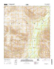
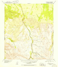
2016 Map of Healy D-2 NW
USGS Topo · Published 2016About this map
Wood River serves as the central drainage for this high-altitude Alaskan landscape, carving a wide valley through the surveyor's grid. The terrain is dominated by significant relief, notably rising to Mystic Mtn in the north. This 2016 survey documents a watershed defined by numerous named tributaries, including the branching flows of Kansas Creek and Virginia Creek in the south, which join the main river as it flows north toward Coal Cr.
Find a feature on this map
17 named features on this map. Tap any name to fly to it.
Don’t see what you’re looking for? This feature index may not catch every label — zoom into the map to look around manually.
Map Details
Editions of this 2016 Healy D-2 NW Map
This is the sole edition of this map. No revisions or reprints were ever made.
Other maps of this area

1949 · Fairbanks A-2
USGS Topo · 1:63,360

1950 · Fairbanks
USGS Topo · 1:250,000

1950 · Fairbanks A-3
USGS Topo · 1:63,360

1950 · Healy D-3
USGS Topo · 1:63,360

1951 · Healy
USGS Topo · 1:250,000

1951 · Fairbanks
USGS Topo · 1:250,000
1951 · Healy D-2
USGS Topo · 1:63,360
1952 · Healy D-3
USGS Topo · 1:63,360
1952 · Healy D-2
USGS Topo · 1:63,360
1952 · Fairbanks A-3
USGS Topo · 1:63,360