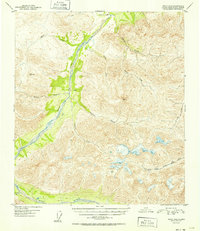
1952 Map of Healy D-2
USGS Topo · Published 1952About this map
The Wood River drainage dominates this interior Alaska landscape, captured during a 1949 aerial survey and published in the early 1950s. The topographic detail highlights a transition from high alpine peaks, such as VABM 5758 Mystic, down to the glacial braids and floodplains of the river valley. A solitary Cabin situated along the central riverbank represents the only human structure noted in this expansive wilderness, suggesting a landscape used primarily for seasonal trapping or early mineral prospecting.
Find a feature on this map
15 named features on this map. Tap any name to fly to it.
Don’t see what you’re looking for? This feature index may not catch every label — zoom into the map to look around manually.
Map Details
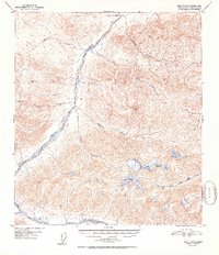
Editions of this 1952 Healy D-2 Map
2 editions found
Other maps of this area

1949 · Healy C-3
USGS Topo · 1:63,360

1949 · Fairbanks A-2
USGS Topo · 1:63,360

1949 · Fairbanks A-1
USGS Topo · 1:63,360

1949 · Healy D-1
USGS Topo · 1:63,360

1950 · Fairbanks
USGS Topo · 1:250,000

1950 · Fairbanks A-3
USGS Topo · 1:63,360

1950 · Healy D-3
USGS Topo · 1:63,360

1951 · Healy
USGS Topo · 1:250,000

1951 · Fairbanks
USGS Topo · 1:250,000

1951 · Healy C-1
USGS Topo · 1:63,360