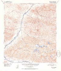
1952 Map of Healy D-2
USGS Topo · Published 1952About this map
Wood River dominates this interior Alaska landscape, its braided channels and vast gravel bars carving a path through the high country of the Fourth Judicial Division. Surveyed from aerial photographs taken in 1949, the map reveals a wilderness shaped by drainage networks where Coal Creek and Mystic Creek feed the main valley from the north. The presence of a solitary .cabin along the riverbank suggests the sparse human footprint typical of this era, likely used by trappers or early prospectors navigating the territory before modern infrastructure. Higher elevations are marked by survey points like VABM 5758 Mystic and VABM 7437 Al, while the southeastern corner introduces the headwaters of the West Fork Little Delta River. The map provides a detailed view of the intricate drainage patterns of Kansas Creek and Virginia Creek, illustrating the complex glacial and alluvial geomorphology of the region.
Find a feature on this map
14 named features on this map. Tap any name to fly to it.
Don’t see what you’re looking for? This feature index may not catch every label — zoom into the map to look around manually.
Map Details
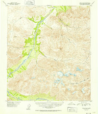
Editions of this 1952 Healy D-2 Map
2 editions found
Other maps of this area

1949 · Healy C-3
USGS Topo · 1:63,360

1949 · Fairbanks A-2
USGS Topo · 1:63,360

1949 · Fairbanks A-1
USGS Topo · 1:63,360

1949 · Healy D-1
USGS Topo · 1:63,360

1950 · Fairbanks
USGS Topo · 1:250,000

1950 · Fairbanks A-3
USGS Topo · 1:63,360

1950 · Healy D-3
USGS Topo · 1:63,360

1951 · Healy
USGS Topo · 1:250,000

1951 · Fairbanks
USGS Topo · 1:250,000

1951 · Healy C-1
USGS Topo · 1:63,360