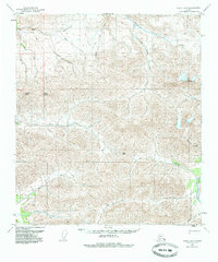
1950 Map of Healy D-3
USGS Topo · Published 1985About this map
Usibelli Peak and Mount Lathrop dominate the high-elevation landscape of this 1950s-era survey, which captures the complex drainage systems of the Alaska Range before modern development. The map reveals an intricate network of waterways, including the winding Healy River and the Wood River, fed by numerous descriptively named tributaries like All Gold Creek, Last Chance Creek, and Surprise Creek. These names suggest a history of prospecting and exploration in the interior.
Find a feature on this map
25 named features on this map. Tap any name to fly to it.
Don’t see what you’re looking for? This feature index may not catch every label — zoom into the map to look around manually.
Map Details
Editions of this 1950 Healy D-3 Map
3 editions found
Other maps of this area

1949 · Healy C-3
USGS Topo · 1:63,360

1949 · Fairbanks A-2
USGS Topo · 1:63,360

1950 · Fairbanks
USGS Topo · 1:250,000

1950 · Healy D-4
USGS Topo · 1:63,360

1950 · Healy C-4
USGS Topo · 1:63,360

1950 · Fairbanks A-4
USGS Topo · 1:63,360

1950 · Fairbanks A-3
USGS Topo · 1:63,360

1950 · Healy D-3
USGS Topo · 1:63,360

1951 · Healy
USGS Topo · 1:250,000

1951 · Fairbanks
USGS Topo · 1:250,000