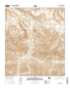
2016 Map of Healy D-3 NE
USGS Topo · Published 2016About this map
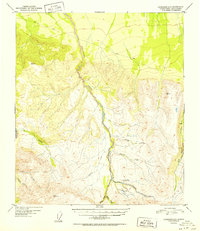
Keevy Peak dominates the southeastern quadrant of this interior Alaska landscape, serving as a prominent sentinel over a complex network of glacial and snow-melt drainages. The area is defined by the headwaters of several significant waterways, including the winding course of Moose Creek and the southern reaches of Gold King Creek. The naming conventions found here—such as Trust Chance Creek, East Chance Creek, and Last Chance Creek—hint at the region's prospecting history, where the naming of every tributary was essential for staking claims and navigating the backcountry.
Find a feature on this map
20 named features on this map. Tap any name to fly to it.
Don’t see what you’re looking for? This feature index may not catch every label — zoom into the map to look around manually.
Map Details
Editions of this 2016 Healy D-3 NE Map
This is the sole edition of this map. No revisions or reprints were ever made.
Other maps of this area

1949 · Fairbanks A-2
USGS Topo · 1:63,360

1950 · Fairbanks
USGS Topo · 1:250,000

1950 · Fairbanks A-3
USGS Topo · 1:63,360

1950 · Healy D-3
USGS Topo · 1:63,360

1951 · Healy
USGS Topo · 1:250,000

1951 · Fairbanks
USGS Topo · 1:250,000
1951 · Healy D-2
USGS Topo · 1:63,360
1952 · Healy D-3
USGS Topo · 1:63,360
1952 · Healy D-2
USGS Topo · 1:63,360
1952 · Fairbanks A-3
USGS Topo · 1:63,360