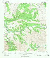
1950 Map of Healy D-4
USGS Topo · Published 1970About this map
The mining and railway operations of the Interior define the landscape of Healy and Suntrana during the mid-century. The Alaska Railroad follows the Nenana River through the Nenana Gorge, serving as the vital transport link for the coal extraction economy. Extensive mining activity is evident along Healy Creek, where the Usibelli Mine and various Strip Mines are located. This industrial footprint contrasts sharply with the southern portion of the map, which marks the northern boundary of Mt McKinley National Park. This area serves as a record of early Alaskan resource development, showing the proximity of active resource extraction to the nascent park boundaries. The terrain is characterized by high peaks such as Jumbo Dome and Walker Dome, which overlook a network of creek drainages including Lignite Creek and Moody Creek.
Find a feature on this map
57 named features on this map. Tap any name to fly to it.
Don’t see what you’re looking for? This feature index may not catch every label — zoom into the map to look around manually.
Map Details
Editions of this 1950 Healy D-4 Map
4 editions found
Other maps of this area

1949 · Healy C-3
USGS Topo · 1:63,360

1950 · Fairbanks
USGS Topo · 1:250,000

1950 · Fairbanks A-5
USGS Topo · 1:63,360

1950 · Healy D-4
USGS Topo · 1:63,360

1950 · Healy C-4
USGS Topo · 1:63,360

1950 · Fairbanks A-4
USGS Topo · 1:63,360

1950 · Fairbanks A-3
USGS Topo · 1:63,360

1950 · Healy D-3
USGS Topo · 1:63,360

1951 · Healy
USGS Topo · 1:250,000

1951 · Fairbanks
USGS Topo · 1:250,000