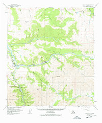
1950 Map of Healy D-4
USGS Topo · Published 1978About this map
Healy Creek and its surrounding coal-rich landscape dominate this interior Alaska survey, capturing a critical era of resource extraction and infrastructure. The industrial heart of the region is centered on settlements like Suntrana and Usibelli, where active coal operations such as the Usibelli Mine, Cripple Creek Mine, and various Strip Mines are connected by short rail spurs. The main line of The Alaska Railroad follows the Nenana River corridor through Healy and Garner, serving as the lifeline for these remote mining communities.
Find a feature on this map
58 named features on this map. Tap any name to fly to it.
Don’t see what you’re looking for? This feature index may not catch every label — zoom into the map to look around manually.
Map Details
Editions of this 1950 Healy D-4 Map
4 editions found
Other maps of this area

1949 · Healy C-3
USGS Topo · 1:63,360

1950 · Fairbanks
USGS Topo · 1:250,000

1950 · Fairbanks A-5
USGS Topo · 1:63,360

1950 · Healy D-4
USGS Topo · 1:63,360

1950 · Healy C-4
USGS Topo · 1:63,360

1950 · Fairbanks A-4
USGS Topo · 1:63,360

1950 · Fairbanks A-3
USGS Topo · 1:63,360

1950 · Healy D-3
USGS Topo · 1:63,360

1951 · Healy
USGS Topo · 1:250,000

1951 · Fairbanks
USGS Topo · 1:250,000