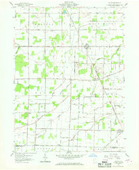
1959 Map of Helena
USGS Topo · Published 1968About this map
Oil extraction and agricultural industry define this landscape on the border of Sandusky and Seneca counties. Extensive Oil Field operations are mapped across several townships, particularly concentrated around the village of Helena. This late 1950s survey documents a network of rural infrastructure including the Pennsylvania Railroad and the New York Chicago and St Louis Railroad, which intersected at Burgoon.
Find a feature on this map
43 named features on this map. Tap any name to fly to it.
Don’t see what you’re looking for? This feature index may not catch every label — zoom into the map to look around manually.
Map Details
Editions of this 1959 Helena Map
2 editions found
Other maps of this area

1901 · Fostoria
USGS Topo · 1:62,500

1901 · Fremont
USGS Topo · 1:62,500

1901 · Elmore
USGS Topo · 1:62,500

1903 · Fremont
USGS Topo · 1:62,500

1903 · Fostoria
USGS Topo · 1:62,500

1903 · Elmore
USGS Topo · 1:62,500

1906 · Tiffin
USGS Topo · 1:62,500

1956 · Toledo
USGS Topo · 1:250,000
1957 · Lindsey
USGS Topo · 1:24,000

1958 · Fremont West
USGS Topo · 1:24,000