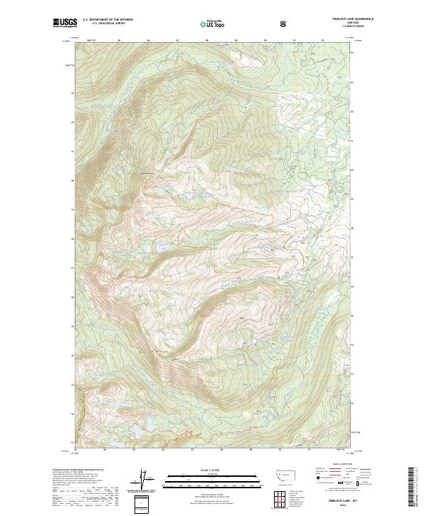
2024 Map of Hemlock Lake
USGS Topo · Published 2024About this map
The Mission Range defines the vertical geography of this terrain, where the Flathead National Forest meets the high-altitude preservation of the Mission Mountains Wilderness. A dense network of glacial water bodies, including Hemlock Lake, Cheff Lake, and the remote Nodimah Lake, sits tucked between sharp elevations like Hemlock Point and Red Butte. This environment is shaped by deep drainage systems such as North Fork Hemlock Creek and Crescent Creek, which flow through a landscape largely inaccessible by modern roads. The infrastructure is primarily composed of historic footpaths and backcountry routes like the Elk Ridge Trl and Glacier Creek Trl, which follow natural ridgelines and valley floors. This map provides a detailed view of the high-country hydrology and the various peaks that characterize the border between Missoula and Lake counties.
Find a feature on this map
40 named features on this map. Tap any name to fly to it.
Don’t see what you’re looking for? This feature index may not catch every label — zoom into the map to look around manually.
Map Details
Editions of this 2024 Hemlock Lake Map
This is the sole edition of this map. No revisions or reprints were ever made.
Other maps of this area

1921 · Elbow Lake
USGS Topo · 1:125,000

1955 · Choteau
USGS Topo · 1:250,000

1957 · Choteau
USGS Topo · 1:250,000

1958 · Choteau
USGS Topo · 1:250,000

1962 · Choteau
USGS Topo · 1:250,000

1965 · Peck Lake
USGS Topo · 1:24,000

1965 · Condon
USGS Topo · 1:24,000

1965 · Gray Wolf Lake
USGS Topo · 1:24,000

1965 · Lake Marshall
USGS Topo · 1:24,000
1965 · St Marys Lake
USGS Topo · 1:24,000