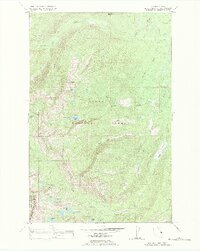
1987 Map of Hemlock Lake
USGS Topo · Published 1987About this map
Flathead National Forest and the Flathead Indian Reservation Tribal Wilderness define this high-elevation landscape along the border of Lake and Missoula counties. The terrain is characterized by a dense network of glacial basins and alpine lakes, including Hemlock Lake, Conko Lake, and North Hemlock Lake. Higher elevations are marked by prominent landforms such as Hemlock Point and Red Butte, which overlook the headwaters of numerous drainages like Elk Creek and Kraft Creek.
Find a feature on this map
30 named features on this map. Tap any name to fly to it.
Don’t see what you’re looking for? This feature index may not catch every label — zoom into the map to look around manually.
Map Details
Editions of this 1987 Hemlock Lake Map
This is the sole edition of this map. No revisions or reprints were ever made.
Other maps of this area

1921 · Elbow Lake
USGS Topo · 1:125,000

1955 · Choteau
USGS Topo · 1:250,000

1957 · Choteau
USGS Topo · 1:250,000

1958 · Choteau
USGS Topo · 1:250,000

1962 · Choteau
USGS Topo · 1:250,000

1965 · Peck Lake
USGS Topo · 1:24,000

1965 · Condon
USGS Topo · 1:24,000

1965 · Gray Wolf Lake
USGS Topo · 1:24,000

1965 · Lake Marshall
USGS Topo · 1:24,000
1965 · St Marys Lake
USGS Topo · 1:24,000