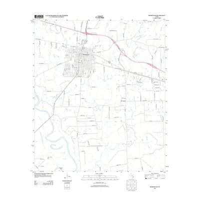
2013 Map of Hempstead
USGS Topo · Published 2013About this map
Hempstead serves as the primary hub of this Waller County landscape, situated where several Farm to Market roads converge north of the Brazos River. The map documents a mix of agricultural land and early 21st-century residential growth, particularly around the city center and the smaller settlement of Pine Island. To the southwest, the Raccoon Bend Oil Field indicates the area's industrial importance, while numerous small water bodies like Clear Cr, Lewisville Cr, and Threemile Cr thread through the terrain. Local history is anchored by sites such as Brenham Cem and a network of family-named routes, including Wyatt Chapel Rd and Joe Loggins Rd, which reflect the community's rural roots. The inclusion of the Old Houston Highway and Liendo Pkwy highlights the long-standing transportation corridors that have shaped this region of Southeast Texas.
Find a feature on this map
86 named features on this map. Tap any name to fly to it.
Don’t see what you’re looking for? This feature index may not catch every label — zoom into the map to look around manually.
Map Details
Editions of this 2013 Hempstead Map
This is the sole edition of this map. No revisions or reprints were ever made.
Other maps of this area

1920 · Waller
USGS Topo · 1:31,680

1950 · Houston
USGS Topo · 1:250,000

1953 · Seguin
USGS Topo · 1:250,000

1954 · Beaumont
USGS Topo · 1:250,000

1954 · Austin
USGS Topo · 1:250,000

1955 · Brookshire
USGS Topo · 1:62,500

1956 · Sealy
USGS Topo · 1:62,500

1956 · Hempstead
USGS Topo · 1:62,500

1956 · Houston
USGS Topo · 1:250,000

1957 · Beaumont
USGS Topo · 1:250,000