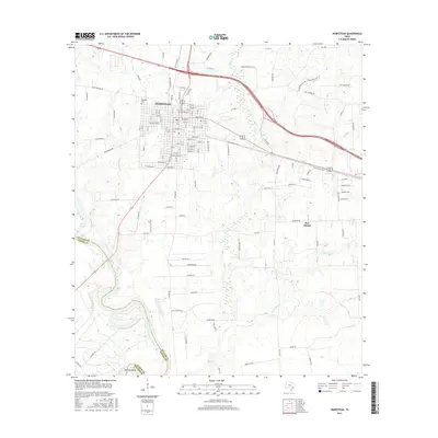
2016 Map of Hempstead
USGS Topo · Published 2016About this map
Hempstead serves as the focal point of this Waller County landscape, situated at the junction of critical regional transit corridors just east of the Brazos River. The map illustrates a transition from the structured grid of the town center to the sprawling rural estates and agricultural tracts that define the surrounding prairie. To the south, Pine Island sits near the headwaters of Threemile Creek, while the southwestern corner follows the meandering course of the river at Raccoon Bend. The local history of the area is etched into the landscape through features like Brenham Cemetery and a network of named roads such as Telephone Rd and Lewisville Rd, which reflect the early infrastructure connecting these Texas settlements. The presence of numerous small drainages like Clear Creek and Ponds Creek indicates the hydrologic complexity of the terrain as it drains toward the Brazos basin.
Find a feature on this map
118 named features on this map. Tap any name to fly to it.
Don’t see what you’re looking for? This feature index may not catch every label — zoom into the map to look around manually.
Map Details
Editions of this 2016 Hempstead Map
This is the sole edition of this map. No revisions or reprints were ever made.
Other maps of this area

1920 · Waller
USGS Topo · 1:31,680

1950 · Houston
USGS Topo · 1:250,000

1953 · Seguin
USGS Topo · 1:250,000

1954 · Beaumont
USGS Topo · 1:250,000

1954 · Austin
USGS Topo · 1:250,000

1955 · Brookshire
USGS Topo · 1:62,500

1956 · Sealy
USGS Topo · 1:62,500

1956 · Hempstead
USGS Topo · 1:62,500

1956 · Houston
USGS Topo · 1:250,000

1957 · Beaumont
USGS Topo · 1:250,000