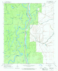
1967 Map of Henrico NE
USGS Topo · Published 1968About this map
The White River carves a winding path through the heart of the White River Wildlife Refuge, defining the border between Arkansas and Phillips counties in the late 1960s. This landscape is a dense network of oxbow lakes and sloughs, including Escronges Lake, Bear Lake, and Long Lake, illustrating the river's historical migration across the floodplain. Human activity is tied closely to the water, evidenced by river access points like Haddons Landing and H Lake Landing, alongside industrial markers like a Pumping Station and a prominent Radio Tower. To the east, the terrain transitions into the agricultural clearings of Mooney Prairie, where structured field lines contrast with the wilder, wooded wetlands of Little Island and the labyrinthine Essex Bayou. This map provides a detailed view of the precarious balance between the managed wildlife habitat and the surrounding rural infrastructure before modern developments further altered the river's course.
Find a feature on this map
50 named features on this map. Tap any name to fly to it.
Don’t see what you’re looking for? This feature index may not catch every label — zoom into the map to look around manually.
Map Details
Editions of this 1967 Henrico NE Map
3 editions found
Other maps of this area

1930 · Mellwood
USGS Topo · 1:62,500

1939 · Modoc
USGS Topo · 1:62,500

1939 · Indian Bay
USGS Topo · 1:62,500

1939 · Henrico
USGS Topo · 1:62,500

1939 · Mellwood
USGS Topo · 1:62,500

1948 · Helena
USGS Topo · 1:250,000

1948 · Modoc
USGS Topo · 1:62,500

1950 · Helena
USGS Topo · 1:250,000

1954 · Mellwood
USGS Topo · 1:62,500

1954 · Indian Bay
USGS Topo · 1:62,500