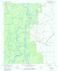
1967 Map of Henrico NE
USGS Topo · Published 1984About this map
The White River National Wildlife Refuge dominates this delta landscape along the boundary of Arkansas and Phillips Counties. Centered on the meandering path of the White River and its secondary channel, the Little White River, the map captures a complex network of oxbow lakes and sloughs typical of the Mississippi River floodplain. Landmarks such as Hudsons Landing and H Lake Landing indicate historical river access points, while the massive Levee system and various floodgates reveal the extensive mid-century water management efforts required to control the seasonal rise of the river.
Find a feature on this map
69 named features on this map. Tap any name to fly to it.
Don’t see what you’re looking for? This feature index may not catch every label — zoom into the map to look around manually.
Map Details
Editions of this 1967 Henrico NE Map
3 editions found
Other maps of this area

1930 · Mellwood
USGS Topo · 1:62,500

1939 · Modoc
USGS Topo · 1:62,500

1939 · Indian Bay
USGS Topo · 1:62,500

1939 · Henrico
USGS Topo · 1:62,500

1939 · Mellwood
USGS Topo · 1:62,500

1948 · Helena
USGS Topo · 1:250,000

1948 · Modoc
USGS Topo · 1:62,500

1950 · Helena
USGS Topo · 1:250,000

1954 · Mellwood
USGS Topo · 1:62,500

1954 · Indian Bay
USGS Topo · 1:62,500