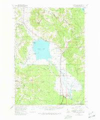
1964 Map of Henrys Lake
USGS Topo · Published 1980About this map
Henrys Lake sits at the center of this high-elevation landscape, where the Continental Divide forms a jagged border between Idaho and Montana. The 1964 terrain reveals a specialized mountain economy of recreation and ranching, evidenced by the Island Park Golf Course and landing areas like Howard Landing Area and Big Springs Landing Area. Private holdings like Johnson Ranch and Webster Ranch are dispersed among the massive tracts of the Targhee National Forest and Gallatin National Forest. Key transit corridors are marked by Reynolds Pass and Targhee Pass, while the small settlement of Henry and the Targhee Cem provide specific points of interest for local history. The map also detail industrial footprints, such as various Gravel Pits and Borrow Pits, alongside prominent peaks like Sawtell Peak and Targhee Peak.
Find a feature on this map
76 named features on this map. Tap any name to fly to it.
Don’t see what you’re looking for? This feature index may not catch every label — zoom into the map to look around manually.
Map Details
Editions of this 1964 Henrys Lake Map
2 editions found

Other maps of this area

1950 · Cliff Lake
USGS Topo · 1:62,500

1950 · Hebgen Dam
USGS Topo · 1:62,500

1950 · Upper Red Rock Lake
USGS Topo · 1:62,500

1955 · Ashton
USGS Topo · 1:250,000

1957 · Buffalo Lake
USGS Topo · 1:62,500

1958 · Ashton
USGS Topo · 1:250,000

1958 · West Yellowstone
USGS Topo · 1:62,500
1958 · Tepee Creek
USGS Topo · 1:62,500

1960 · Ashton
USGS Topo · 1:250,000

1964 · Island Park
USGS Topo · 1:24,000