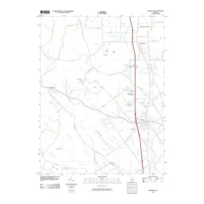
2010 Map of Henryville
USGS Topo · Published 2010About this map
The town of Henryville and the nearby community of Underwood anchor this region of Clark County, Indiana, where the CSX railroad corridor parallels the modern highway system. The landscape transition is evident at the Silver Hills, where the relatively level agricultural and residential lands of the east give way to a more complex terrain of knobs and drainages to the west. Landmarks like the Purdue University Forestry Camp and Mount Zion Cemetery provide key geographic and genealogical reference points for the area.
Find a feature on this map
129 named features on this map. Tap any name to fly to it.
Don’t see what you’re looking for? This feature index may not catch every label — zoom into the map to look around manually.
Map Details
Editions of this 2010 Henryville Map
This is the sole edition of this map. No revisions or reprints were ever made.
Other maps of this area

1905 · Prospect
USGS Topo · 1:62,500

1912 · Prospect
USGS Topo · 1:62,500

1937 · Charlestown
USGS Topo · 1:24,000

1938 · Speed
USGS Topo · 1:24,000

1941 · Borden
USGS Topo · 1:24,000

1947 · Speed
USGS Topo · 1:24,000

1947 · Scottsburg
USGS Topo · 1:24,000

1949 · Henryville
USGS Topo · 1:24,000
1950 · Charlestown
USGS Topo · 1:24,000

1955 · South Boston
USGS Topo · 1:24,000