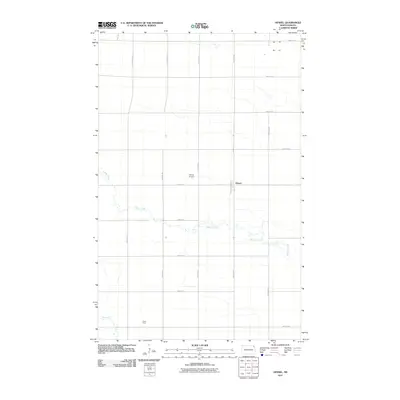
2011 Map of Hensel
USGS Topo · Published 2011About this map
Hensel serves as the primary settlement within this section of Pembina County, surrounded by a precise grid of rural section lines and agricultural infrastructure. The landscape is defined by the winding course of Willow Creek, which meanders east across the prairie, joined by smaller drainages like Cart Creek to the south. This 2011 survey highlights the intersection of transportation and family-scale land use, featuring the Hensel Airport and named properties such as Estad Farm. The survey records a high-resolution view of the local road network, from major arteries like County Rd 12 and County Rd 3 to numbered township roads such as 138th Ave NE and 90th St NE. These labels provide a detailed spatial index of the region's farming economy and rural development in the early 21st century.
Find a feature on this map
19 named features on this map. Tap any name to fly to it.
Don’t see what you’re looking for? This feature index may not catch every label — zoom into the map to look around manually.
Map Details
Editions of this 2011 Hensel Map
This is the sole edition of this map. No revisions or reprints were ever made.
Other maps of this area

1918 · Walhalla
USGS Topo · 1:62,500

1939 · Cavalier
USGS Topo · 1:62,500

1941 · Cavalier
USGS Topo · 1:62,500

1943 · Walhalla
USGS Topo · 1:62,500

1944 · Crystal
USGS Topo · 1:62,500

1952 · Thief River Falls
USGS Topo · 1:250,000

1956 · Thief River Falls
USGS Topo · 1:250,000

1957 · Thief River Falls
USGS Topo · 1:250,000

1963 · Crystal SE
USGS Topo · 1:24,000

1963 · Crystal
USGS Topo · 1:24,000