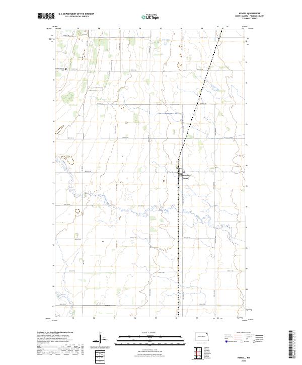
2024 Map of Hensel
USGS Topo · Published 2024About this map
Hensel and the adjacent Canton City anchor this portion of the Red River Valley, where the grid of Pembina County's rural roads meets the winding path of Willow Creek. The landscape is dominated by large-scale agricultural blocks, defined by the Public Land Survey System township and range lines. The northern reaches of the map include the Vidalin Lutheran Cem, a significant site for local genealogical research situated along 91st St NE. The drainage patterns of Cart Creek in the southwest corner contrast with the rigid north-south orientation of arterial routes like Hwy 12 and 137th Ave NE. This modern survey reflects the enduring settlement patterns of northeastern North Dakota, where small agricultural hubs and isolated historic sites remain the primary landmarks across the prairie.
Find a feature on this map
28 named features on this map. Tap any name to fly to it.
Don’t see what you’re looking for? This feature index may not catch every label — zoom into the map to look around manually.
Map Details
Editions of this 2024 Hensel Map
This is the sole edition of this map. No revisions or reprints were ever made.
Other maps of this area

1918 · Walhalla
USGS Topo · 1:62,500

1939 · Cavalier
USGS Topo · 1:62,500

1941 · Cavalier
USGS Topo · 1:62,500

1943 · Walhalla
USGS Topo · 1:62,500

1944 · Crystal
USGS Topo · 1:62,500

1952 · Thief River Falls
USGS Topo · 1:250,000

1956 · Thief River Falls
USGS Topo · 1:250,000

1957 · Thief River Falls
USGS Topo · 1:250,000

1963 · Crystal SE
USGS Topo · 1:24,000

1963 · Crystal
USGS Topo · 1:24,000