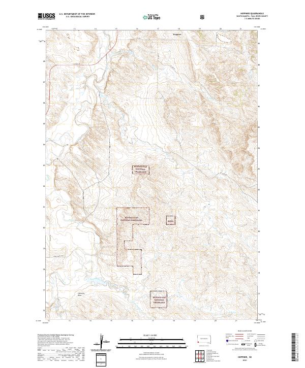
2021 Map of Heppner
USGS Topo · Published 2021About this map
Heppner sits at the northern edge of this high plains landscape in Fall River County, where the sprawling Buffalo Gap National Grassland dominates the central and southern terrain. The drainage patterns here are well-defined by intermittent waterways such as Hat Cr, Ash Cr, and Bitter Cr, which carve through the dry draws and grassy plateaus. This 2021 topographic record reveals a sparse human footprint, primarily consisting of remote county roads like Cascade Rd and Ash Creek Rd that connect isolated ranching parcels and public lands. In the southwest, Horse Cr and the Horse Creek Loop indicate the area's use for grazing and recreation, while Lightning Draw and Long Hollow Creek illustrate the natural erosion of the South Dakota prairie.
Find a feature on this map
24 named features on this map. Tap any name to fly to it.
Don’t see what you’re looking for? This feature index may not catch every label — zoom into the map to look around manually.
Map Details
Editions of this 2021 Heppner Map
This is the sole edition of this map. No revisions or reprints were ever made.
Other maps of this area

1896 · Oelrichs
USGS Topo · 1:125,000

1900 · Oelrichs
USGS Topo · 1:125,000

1902 · Edgemont
USGS Topo · 1:125,000

1950 · Heppner
USGS Topo · 1:24,000

1950 · Cascade Springs
USGS Topo · 1:24,000

1950 · Angostura Reservoir
USGS Topo · 1:24,000

1950 · Rumford
USGS Topo · 1:24,000

1950 · Flint Hill
USGS Topo · 1:24,000

1955 · Hot Springs
USGS Topo · 1:250,000
1982 · Black Banks Creek West
USGS Topo · 1:25,000