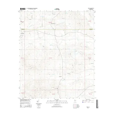
2015 Map of Hero
USGS Topo · Published 2015About this map
Mount Vernon and Garlandville anchor the northern reaches of this landscape along the border of Newton and Jasper counties. The area is defined by a dense network of meandering waterways, including Scotchenflipper Cr, Souenlovie Cr, and Penantly Cr, which carve through the terrain. Small settlements and points of interest like Hero and Penantly are connected by a web of rural routes such as Stamper Rd and Walker Rd. Local history is preserved in sites like the Garlandville Cem and Hopewell Cem, while the landscape is punctuated by water features like Horne Mill Pond and Kennedy Pond. The map reveals a rural Mississippi environment where community centers are deeply tied to the natural drainage patterns of the N Twistwood Cr watershed.
Find a feature on this map
33 named features on this map. Tap any name to fly to it.
Don’t see what you’re looking for? This feature index may not catch every label — zoom into the map to look around manually.
Map Details
Editions of this 2015 Hero Map
This is the sole edition of this map. No revisions or reprints were ever made.
Other maps of this area

1953 · Meridian
USGS Topo · 1:250,000

1957 · Meridian
USGS Topo · 1:250,000

1957 · Chunky
USGS Topo · 1:62,500

1957 · Enterprise
USGS Topo · 1:62,500

1965 · Meridian
USGS Topo · 1:250,000

1966 · Hickory
USGS Topo · 1:24,000

1966 · Newton
USGS Topo · 1:24,000

1970 · Paulding
USGS Topo · 1:24,000

1970 · Hero
USGS Topo · 1:24,000
1970 · Montrose North
USGS Topo · 1:24,000