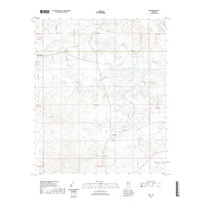
2020 Map of Hero
USGS Topo · Published 2020About this map
Garlandville sits at the western edge of this landscape, marking an area defined by the headwaters and winding tributaries that cross the boundary between Newton and Jasper counties. The terrain is shaped by an intricate network of watercourses, including Souenlovie Cr and the curiously named Scotchenflipper Cr, which drain the lowlands between rises like Moss Hill. Small, dispersed settlements such as Hero and Penantly are linked by a grid of county roads, reflecting a late-20th and early-21st-century rural character focused on land management and local agriculture. The presence of Garlandville Cem and Hopewell Cem offers specific points of interest for those researching local family histories, while features like Horne Mill Pond hint at the historical reliance on these small waterways for local industry or recreation.
Find a feature on this map
64 named features on this map. Tap any name to fly to it.
Don’t see what you’re looking for? This feature index may not catch every label — zoom into the map to look around manually.
Map Details
Editions of this 2020 Hero Map
This is the sole edition of this map. No revisions or reprints were ever made.
Other maps of this area

1953 · Meridian
USGS Topo · 1:250,000

1957 · Meridian
USGS Topo · 1:250,000

1957 · Chunky
USGS Topo · 1:62,500

1957 · Enterprise
USGS Topo · 1:62,500

1965 · Meridian
USGS Topo · 1:250,000

1966 · Hickory
USGS Topo · 1:24,000

1966 · Newton
USGS Topo · 1:24,000

1970 · Paulding
USGS Topo · 1:24,000

1970 · Hero
USGS Topo · 1:24,000
1970 · Montrose North
USGS Topo · 1:24,000