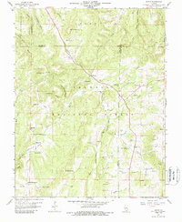
1959 Map of Herod
USGS Topo · Published 1988About this map
Shawnee National Forest encompasses much of this terrain in southeastern Illinois, where the landscape is defined by the sharp ridges of Williams Hill and Wamble Mountain. Small community life in the late 1950s centered on scattered rural institutions such as Bethesda Ch, Honeycomb Ch, and Crossroads Sch. The map reveals a deeply etched drainage system where Grand Pierre Creek and Gibbons Creek wind through numerous hollows, supporting a legacy of small-scale extraction and family homesteading.
Find a feature on this map
67 named features on this map. Tap any name to fly to it.
Don’t see what you’re looking for? This feature index may not catch every label — zoom into the map to look around manually.
Map Details
Editions of this 1959 Herod Map
3 editions found
Other maps of this area

1916 · Golconda
USGS Topo · 1:62,500

1916 · Equality
USGS Topo · 1:62,500

1917 · Brownfield
USGS Topo · 1:62,500

1920 · Goloonda
USGS Topo · 1:48,000

1921 · Golconda
USGS Topo · 1:62,500

1925 · Harrisburg
USGS Topo · 1:62,500

1939 · Harrisburg
USGS Topo · 1:62,500

1949 · Paducah
USGS Topo · 1:250,000

1950 · Paducah
USGS Topo · 1:250,000

1954 · Paducah
USGS Topo · 1:250,000