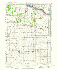
1923 Map of Herscher
USGS Topo · Published 1964About this map
The Kankakee River winds across the northern reaches of this landscape, anchoring a region defined by intense agricultural development and the intersection of major rail corridors. Surveyed in the early 1920s, the map reveals a dense network of country schools like Robinson School and Pilot Center School that served the farmsteads between expanding towns. The landscape is marked by the industrial presence of the Lehigh Stone Co Quarry near Lehigh, signaling the importance of mineral extraction alongside the region's grain economy.
Find a feature on this map
70 named features on this map. Tap any name to fly to it.
Don’t see what you’re looking for? This feature index may not catch every label — zoom into the map to look around manually.
Map Details
Editions of this 1923 Herscher Map
2 editions found
Other maps of this area

1892 · Morris
USGS Topo · 1:62,500

1892 · Wilmington
USGS Topo · 1:62,500

1918 · Wilmington
USGS Topo · 1:62,500

1918 · Morris
USGS Topo · 1:62,500

1922 · Kankakee
USGS Topo · 1:62,500

1923 · Herscher
USGS Topo · 1:62,500

1924 · Kankakee
USGS Topo · 1:62,500

1925 · Herscher
USGS Topo · 1:62,500

1944 · Piper City
USGS Topo · 1:48,000

1944 · Gilman
USGS Topo · 1:62,500