
1966 Map of Hiawatha
USGS Topo · Published 1969About this map
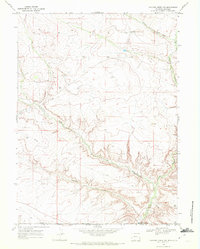
The Oil Field at Hiawatha serves as the focal point for this mid-1960s study of the high-desert borderland between Colorado and Wyoming. Infrastructure related to energy extraction is scattered across the landscape, including a Pumping Sta, several Oil Well sites, and a Drill Hole. The terrain is deeply incised by drainages such as Shell Creek, Vermillion Creek, and the aptly named Hells Canyon. Navigation through this dissected country is limited to an unpaved network, notably a remote Jeep Trail that crosses Dry Creek in the southern portion of the quadrangle. The map clearly delineates the political boundary between Sweetwater County and Moffat County, illustrating how the industrial footprint of the oil field ignores state lines in favor of the underlying geology.
Find a feature on this map
13 named features on this map. Tap any name to fly to it.
Don’t see what you’re looking for? This feature index may not catch every label — zoom into the map to look around manually.
Map Details
Editions of this 1966 Hiawatha Map
This is the sole edition of this map. No revisions or reprints were ever made.
Other maps of this area

1954 · Vernal
USGS Topo · 1:250,000

1954 · Rock Springs
USGS Topo · 1:250,000

1958 · Vernal
USGS Topo · 1:250,000

1958 · Rock Springs
USGS Topo · 1:250,000

1960 · Vernal
USGS Topo · 1:250,000

1962 · Rock Springs
USGS Topo · 1:250,000

1966 · G Spring
USGS Topo · 1:24,000

1966 · Sugarloaf Butte
USGS Topo · 1:24,000

1966 · Irish Canyon
USGS Topo · 1:24,000
1968 · Chicken Creek SW
USGS Topo · 1:24,000