
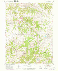
1953 Map of Higbee
USGS Topo · Published 1955About this map
Higbee stands as a primary rail hub in central Missouri during the mid-1950s, situated at the junction of the Gulf Mobile and Ohio and the Missouri Kansas Texas railroads. The town's industrial footprint is clearly visible through several local extractions, including a Mine Dump and Strip Mine located nearby. The surrounding rural landscape, spanning parts of Moniteau and Salt Spring Prairie, is dotted with foundational community landmarks like the Pemberton Sch and Possum Sch.
Find a feature on this map
22 named features on this map. Tap any name to fly to it.
Don’t see what you’re looking for? This feature index may not catch every label — zoom into the map to look around manually.
Map Details
Editions of this 1953 Higbee Map
2 editions found
Other maps of this area

1890 · Moberly
USGS Topo · 1:125,000

1890 · Glasgow
USGS Topo · 1:125,000

1917 · Sturgeon
USGS Topo · 1:62,500

1953 · Moberly
USGS Topo · 1:250,000

1953 · Fayette
USGS Topo · 1:24,000

1953 · Burton
USGS Topo · 1:24,000

1953 · Renick
USGS Topo · 1:24,000

1953 · Huntsville
USGS Topo · 1:24,000

1953 · Armstrong
USGS Topo · 1:24,000

1953 · Clifton Hill
USGS Topo · 1:24,000