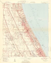
1951 Map of Highland Park
USGS Topo · Published 1951About this map
Fort Sheridan and the busy coastal corridor of Lake County dominate this early 1950s survey, showing a landscape defined by rail lines and lakefront estates. The area between Lake Forest and Glencoe is exceptionally detailed, featuring institutions like Lake Forest College, Ferry Hall Academy, and the Sacred Heart Seminary. This era captures the North Shore at a peak of rail-dependent transit, with the Chicago and North Western, Chicago North Shore and Milwaukee, and Chicago Milwaukee St Paul and Pacific railroads all running parallel through the quadrangle.
Find a feature on this map
67 named features on this map. Tap any name to fly to it.
Don’t see what you’re looking for? This feature index may not catch every label — zoom into the map to look around manually.
Map Details
Editions of this 1951 Highland Park Map
2 editions found
Other maps of this area

1899 · Evanston
USGS Topo · 1:62,500

1900 · Highwood
USGS Topo · 1:62,500

1906 · Waukegan
USGS Topo · 1:62,500

1908 · Waukegan
USGS Topo · 1:62,500

1927 · Arlington Heights
USGS Topo · 1:24,000

1928 · Wheeling
USGS Topo · 1:24,000

1928 · Highland Park
USGS Topo · 1:24,000

1928 · Evanston
USGS Topo · 1:24,000

1929 · Park Ridge
USGS Topo · 1:24,000

1951 · Highland Park
USGS Topo · 1:24,000