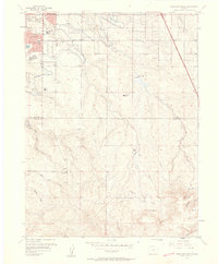
1957 Map of Highlands Ranch
USGS Topo · Published 1958About this map
Highlands Ranch and the surrounding drainages of Douglas and Arapahoe counties appear here during a period of mid-century expansion south of Denver. The map captures a mix of legacy agricultural operations and emerging residential pockets, such as Greenwood Village and the developing outskirts of Littleton. Large-scale ranching history is evidenced by the Cheese Ranch (Aband) and Mc Arthur Ranch, while the infrastructure of the era is marked by the Electronic Equipment Plant and the Bar None Airport. The Highline Canal winds across the northern landscape, a critical piece of water management alongside the Englewood Dam and Gallup Res. This survey provides a precise look at the transition from open grazing land to suburban development, documented just as modern local landmarks like Chapel Hill Memorial Gardens Cemetery and the Curtis Sch were established.
Find a feature on this map
30 named features on this map. Tap any name to fly to it.
Don’t see what you’re looking for? This feature index may not catch every label — zoom into the map to look around manually.
Map Details
Editions of this 1957 Highlands Ranch Map
2 editions found
Other maps of this area

1890 · East Denver
USGS Topo · 1:125,000

1893 · Platte Canyon
USGS Topo · 1:125,000

1894 · Castle Rock
USGS Topo · 1:125,000

1899 · West Denver
USGS Topo · 1:125,000

1913 · Castle Rock
USGS Topo · 1:125,000

1935 · East Denver Nos. 3 and 4
USGS Topo · 1:48,000

1940 · Englewood
USGS Topo · 1:31,680

1940 · Castle Rock
USGS Topo · 1:62,500

1941 · Fitzsimons
USGS Topo · 1:31,680

1941 · Fort Logan
USGS Topo · 1:31,680