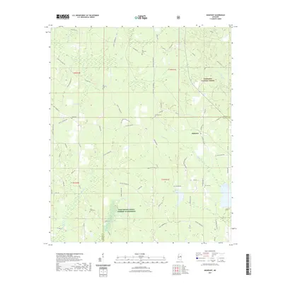
2021 Map of Highpoint
USGS Topo · Published 2021About this map
Highpoint sits along the dividing line of Choctaw Co and Winston Co, serving as a central marker in a landscape defined by traditional rural settlements and vast forestry. This area is heavily influenced by the Tombigbee National Forest, which covers much of the eastern terrain where the Little Noxubee River and Tallahagga Cr flow through the timberlands. The map reveals a high density of rural cemeteries, such as Big Jerusalem Cem and Bethsalem Cem, which point to longstanding community congregations scattered throughout the hills.
Find a feature on this map
77 named features on this map. Tap any name to fly to it.
Don’t see what you’re looking for? This feature index may not catch every label — zoom into the map to look around manually.
Map Details
Editions of this 2021 Highpoint Map
This is the sole edition of this map. No revisions or reprints were ever made.
Other maps of this area

1953 · West Point
USGS Topo · 1:250,000

1958 · West Point
USGS Topo · 1:250,000

1963 · West Point
USGS Topo · 1:250,000

1966 · Weir
USGS Topo · 1:24,000

1968 · Weir
USGS Topo · 1:62,500

1972 · Louisville North
USGS Topo · 1:24,000

1972 · McCool
USGS Topo · 1:24,000

1972 · Highpoint
USGS Topo · 1:24,000
1972 · Ethel SE
USGS Topo · 1:24,000
1972 · Louisville South
USGS Topo · 1:24,000