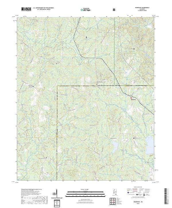
2024 Map of Highpoint
USGS Topo · Published 2024About this map
The Highpoint community sits along the border of Choctaw Co and Winston Co in this rural Mississippi landscape. This area is characterized by a high concentration of historic religious and burial sites, including the Bethsalem Presbyterian Church and the Salem United Methodist Church Cem. The topography is defined by the headwaters of several significant drainages, including the Little Noxubee River and Tallahaga Creek, which carve through the timberlands of the Tombigbee National Forest.
Find a feature on this map
79 named features on this map. Tap any name to fly to it.
Don’t see what you’re looking for? This feature index may not catch every label — zoom into the map to look around manually.
Map Details
Editions of this 2024 Highpoint Map
This is the sole edition of this map. No revisions or reprints were ever made.
Other maps of this area

1953 · West Point
USGS Topo · 1:250,000

1958 · West Point
USGS Topo · 1:250,000

1963 · West Point
USGS Topo · 1:250,000

1966 · Weir
USGS Topo · 1:24,000

1968 · Weir
USGS Topo · 1:62,500

1972 · Louisville North
USGS Topo · 1:24,000

1972 · McCool
USGS Topo · 1:24,000

1972 · Highpoint
USGS Topo · 1:24,000
1972 · Ethel SE
USGS Topo · 1:24,000
1972 · Louisville South
USGS Topo · 1:24,000