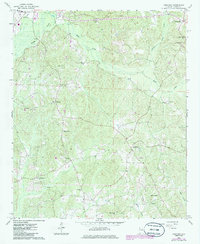
1967 Map of Hightogy
USGS Topo · Published 1986About this map
Vernon anchors the northwestern corner of this West Alabama landscape, where the town's early residential and institutional core, including a Hospital, meets the upper reaches of Yellow Creek. The terrain is characterized by a dense network of country churches and family-linked landmarks, such as South Carolina Ch and Christian Chapel, which served the scattered rural communities in the mid-20th century.
Find a feature on this map
32 named features on this map. Tap any name to fly to it.
Don’t see what you’re looking for? This feature index may not catch every label — zoom into the map to look around manually.
Map Details
Editions of this 1967 Hightogy Map
3 editions found
Other maps of this area

1953 · Birmingham
USGS Topo · 1:250,000

1953 · West Point
USGS Topo · 1:250,000

1956 · Birmingham
USGS Topo · 1:250,000

1957 · Birmingham
USGS Topo · 1:250,000

1958 · West Point
USGS Topo · 1:250,000

1963 · West Point
USGS Topo · 1:250,000

1967 · Hightogy
USGS Topo · 1:24,000

1967 · Kennedy
USGS Topo · 1:24,000

1967 · Bluff
USGS Topo · 1:24,000

1967 · Millport
USGS Topo · 1:24,000