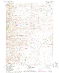
1953 Map of Hightower SW
USGS Topo · Published 1985About this map
The Laramie River and its complex network of seasonal tributaries define this Platte County landscape during the mid-20th century. Highlighting the intersection of ranching and early infrastructure, the map details the Cramer Ditch and Mertz Ditch systems, which provided essential water management for the arid terrain. Settlement patterns are visible through the location of the Wedemeyer School and Slate Creek Sch, both noted as abandoned by the time of the 1953 field check, suggesting a shift in the local rural population.
Find a feature on this map
29 named features on this map. Tap any name to fly to it.
Don’t see what you’re looking for? This feature index may not catch every label — zoom into the map to look around manually.
Map Details
Editions of this 1953 Hightower SW Map
5 editions found
Other maps of this area

1953 · Lewis Flat
USGS Topo · 1:24,000

1953 · Hightower
USGS Topo · 1:24,000

1953 · Natwick
USGS Topo · 1:24,000

1953 · Squaw Rock
USGS Topo · 1:24,000

1953 · Hightower SW
USGS Topo · 1:24,000

1953 · Johnson Mountain
USGS Topo · 1:24,000

1954 · Torrington
USGS Topo · 1:250,000

1954 · Cheyenne
USGS Topo · 1:250,000

1955 · Moonshine Peak
USGS Topo · 1:24,000

1958 · Cheyenne
USGS Topo · 1:250,000