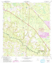
1961 Map of Hillcoat
USGS Topo · Published 1993About this map
Suwannee River carves a winding path along the boundary between Hamilton and Suwannee Counties, defining the lower portion of this landscape. The rural character of the area is evidenced by a network of small churches and family burial grounds, including Mt Pisgah Cem, Nunn Cem, and Peterson Cem. Near the river, Suwannee Springs serves as a local landmark, accompanied by the Suwannee Springs Ch.
Find a feature on this map
33 named features on this map. Tap any name to fly to it.
Don’t see what you’re looking for? This feature index may not catch every label — zoom into the map to look around manually.
Map Details
Editions of this 1961 Hillcoat Map
2 editions found
Other maps of this area

1954 · Valdosta
USGS Topo · 1:250,000

1955 · Jasper
USGS Topo · 1:24,000

1955 · Cypress Creek
USGS Topo · 1:24,000

1956 · Jennings
USGS Topo · 1:24,000

1958 · Valdosta
USGS Topo · 1:250,000

1958 · Fort Union
USGS Topo · 1:24,000

1959 · Valdosta
USGS Topo · 1:250,000

1959 · Live Oak West
USGS Topo · 1:24,000

1961 · Live Oak East
USGS Topo · 1:24,000

1961 · Hillcoat
USGS Topo · 1:24,000