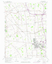
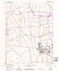
1966 Map of Hilliard
USGS Topo · Published 1974About this map
Franklin County's farming roots meet mid-century suburban expansion in this survey of Hilliard and its outlying rural hamlets. The Penn Central rail line cuts diagonally across the landscape, linking the county seat to the small communities of Amlin and Kileville. While the core of Hilliard shows a concentrated grid including the County Fairground, Hamilton Park School, and Reason School, the surrounding townships of Norwich and Washington remain largely defined by family-named roads and agrarian markers.
Find a feature on this map
80 named features on this map. Tap any name to fly to it.
Don’t see what you’re looking for? This feature index may not catch every label — zoom into the map to look around manually.
Map Details
Editions of this 1966 Hilliard Map
5 editions found
Other maps of this area

1901 · Dublin
USGS Topo · 1:62,500

1903 · Dublin
USGS Topo · 1:62,500

1907 · London
USGS Topo · 1:62,500

1916 · Milford Center
USGS Topo · 1:62,500

1923 · West Columbus
USGS Topo · 1:62,500

1925 · West Columbus
USGS Topo · 1:62,500

1944 · Milford Center
USGS Topo · 1:62,500

1947 · Columbus
USGS Topo · 1:250,000

1950 · Marion
USGS Topo · 1:250,000
1954 · Shawnee Hills
USGS Topo · 1:24,000