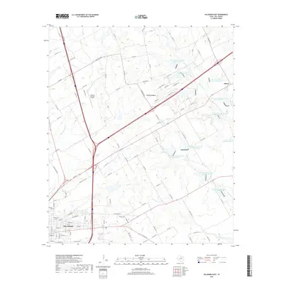
2019 Map of Hillsboro East
USGS Topo · Published 2019About this map
Hillsboro serves as the focal point of this Texas survey, where the urban grid meets the agricultural reaches of Hill County. The transition from the town's residential streets to the surrounding rural landscape is defined by a sophisticated network of water management, evidenced by numerous numbered reservoirs like Soil Conservation Service Site 56 Reservoir and Soil Conservation Service Site 61 Reservoir. These sites, along with Isenberg Lake, highlight the region's reliance on soil and water conservation infrastructure to support its ranching and farming operations.
Find a feature on this map
101 named features on this map. Tap any name to fly to it.
Don’t see what you’re looking for? This feature index may not catch every label — zoom into the map to look around manually.
Map Details
Editions of this 2019 Hillsboro East Map
This is the sole edition of this map. No revisions or reprints were ever made.
Other maps of this area

1891 · Cleburne
USGS Topo · 1:125,000

1892 · Waco
USGS Topo · 1:125,000

1894 · Cleburne
USGS Topo · 1:125,000

1920 · Waco
USGS Topo · 1:125,000

1954 · Dallas
USGS Topo · 1:250,000

1954 · Waco
USGS Topo · 1:250,000

1955 · Waco
USGS Topo · 1:250,000

1956 · Abbott
USGS Topo · 1:24,000
1957 · Peoria
USGS Topo · 1:24,000
1957 · Malone
USGS Topo · 1:24,000